


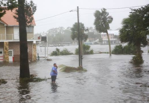

INTERNEWSTIMES.COM – The Gulf Coast is on high alert as Hurricane Helene, a Category Two storm that’s rapidly gaining strength, barrels towards western Florida. Forecasters predict Helene will morph into a major hurricane, reaching Category 3 intensity, before making landfall late Thursday or early Friday. The storm’s arrival promises a devastating cocktail of dangers: a catastrophic and potentially deadly storm surge, heavy rainfall, and powerful winds.

The threat is most severe in the western Florida panhandle, where some areas could face a catastrophic storm surge of up to six meters above ground level. Even areas east of the storm’s center will experience significant impacts, facing heavy rainfall, strong winds, and a dangerous storm surge.


Florida Governor Ron DeSantis has declared a state of emergency for nearly all of the state’s counties, mobilizing the National Guard in preparation for potential rescue operations and power restoration. The state is also working closely with federal agencies to ensure swift and effective disaster relief. President Joe Biden has been briefed on the situation and his administration is ready to provide assistance to affected states.

This storm is a stark reminder of the increasing threat of hurricanes due to rising ocean temperatures. The hurricane center’s prediction of a major hurricane is fueled by the favorable atmospheric and oceanic conditions in the eastern Gulf of Mexico.
With Helene poised to make landfall and Tropical Storm Isaac forming in the Atlantic, this hurricane season is already proving to be a formidable one. The future of this storm remains uncertain, but one thing is clear: Florida is bracing for a powerful and potentially destructive hurricane. (Red)